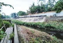
ILOILO City – Determined to address flooding with science-driven solutions, the Iloilo City Government has tapped three hydrologic experts from the University of the Philippines-Diliman (UPD) to craft updated flood models that will shape the city’s climate-resilient development and drainage master plan.
Under a four-month engagement, Dr. Gil Cruz, a civil engineer specializing in hydraulics, together with engineers Franz D. Santos and Chiny Vispo, will conduct hydrologic model simulations, analyze river discharges, and map out potential flood scenarios in the city’s most vulnerable barangays.
Donna Magno, head of the Iloilo City Disaster Risk Reduction and Management Office (CDRRMO), stressed that the city’s outdated data no longer reflects today’s flood risks.
“It has been a long time since a hydrologic and flood susceptibility study was done for the city. Now, developments have grown tremendously, and the old data no longer apply to our situation. We need updated information so that we can prepare properly,” she explained.
A total of P600,000 from the CDRRMO fund has been allocated for the experts’ honoraria.
Magno said the investment is both strategic and necessary.
“Our goal is to produce a clearer picture so that our response will not only be reactive but also proactive and long-term,” she stressed.
The results of the study will serve as the backbone of Iloilo City’s comprehensive drainage master plan, according to Magno.
“The results of this study will serve as the backbone of our comprehensive drainage master plan. This is not only about designing roads or drainage systems, but about making sure that development in the city is appropriate and climate-resilient,” she said.
Beyond technical modeling, the team will conduct field surveys, baseline studies, and preliminary assessments to test various flooding scenarios.
“Their work is not just about numbers. They will analyze possible impacts — how deep the water can get, how wide the flooding may spread, and how this will affect barangays. This is the kind of data we truly need,” Magno added./PN


