


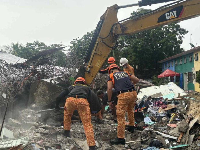
ILOILO City – Western Visayas is on heightened alert. The Office of Civil Defense (OCD) has issued an urgent directive ordering immediate inspections of buildings and critical infrastructure across the region after the magnitude 6.9 earthquake that rocked Cebu late Tuesday night and was strongly felt in Panay, Guimaras, and Negros islands.
The sweeping order covers schools, hospitals, bridges, highways, government offices, public housing, and high-occupancy buildings — structures most at risk of collapse or serious damage if left unchecked.
All local disaster risk reduction and management councils, engineering offices, and building officials are under strict instructions to mobilize their teams without delay.
“Every structure that has been weakened by this earthquake poses a possible danger to our communities. We must act quickly to identify risks and recommend solutions, whether through repairs, retrofitting, or clearing unsafe facilities,” declared OCD Region 6 director Raul Fernandez, who also chairs the Regional Disaster Risk Reduction and Management Council (RDRRMC).
The earthquake was felt around 9:59 p.m. Although the epicenter was in Bogo City, Cebu its strength was felt across large swathes of the Visayas.
Fernandez underscored that protecting lives hinges on a coordinated response: “Protecting lives is our highest priority, and this can only be achieved if all stakeholders work together and report promptly.”
Inspectors will use modern tools such as laser scanners and structural analysis software to detect hidden weaknesses.
Cracks, leaning walls, sinking foundations, and unstable roofs are among the red flags being monitored.
Teams will classify buildings according to the level of risk — from those needing minor repairs to those that must be condemned outright.
Particular attention will be given to older structures not built under present seismic standards, many of which remain occupied by families, students, and patients.
The OCD-6 emphasized that high-density facilities must be prioritized, as even a partial collapse could result in mass casualties.
Beyond government-led efforts, authorities are calling on residents to remain vigilant. Citizens are urged to document and report any sign of damage, however small, in their homes, offices, and neighborhoods.
“Community vigilance is key,” Fernandez said. “By fostering cooperation, we can strengthen our defenses against future disasters.”
As Western Visayas braces for possible aftershocks, the RDRRMC stressed that local governments must feed timely information into the regional response network to shape rescue, relief, and long-term recovery planning.
1948 ‘Lady Caycay’ Quake
The most potent earthquake ever recorded on Panay Island occurred on January 25, 1948 — a magnitude 7.8 tremor dubbed the “Lady Caycay” earthquake.
Centered near Anini-y, Antique, its Mercalli intensity reached X (“Extreme”), ripping open fissures across Iloilo and Antique, and causing a small tsunami that reportedly killed two along the Iloilo Strait.
The destruction was widespread, and more evident on Spanish-era churches — 55 were hit and 17 collapsed outright. In Iloilo alone, belfries of historic churches in Jaro, San Joaquin, Arevalo and others toppled.
Reports at that time told of approximately 21 fatalities and 43 injuries.
Infrastructure failure included large ground fissures (some up to four meters wide) and crumbling bridges and some buildings.
The “Lady Caycay” earthquake remains the second-strongest in Philippine history, surpassed only by the 7.8 magnitude event near Luzon in 1990, and serves as a reminder: Panay Island is highly vulnerable to intense seismic activity due to the West Panay Fault.
The West Panay Fault is a significant geological fault line. It stretches over 90 kilometers, traversing towns in Iloilo (San Joaquin, Miag-ao, Igbaras, Tubungan, Leon, Alimodian, Janiuay, Lambunao), Antique (Sibalom, San Remigio, Valderrama, Pandan), Capiz (Tapaz, Jamindan), and Aklan (Libacao, Madalag, Malinao)./PN

