


JORDAN, Guimaras – The Philippine Statistics Authority (PSA) Guimaras Provincial Statistical Office is currently updating geotagged building structures and geotagged economic areas in the municipalities of Buenavista and Jordan, now reaching 59.46% of the provincial target as of Sept. 29.
The geotagging started on Aug. 16 is expected to end on Oct. 15.
“This undertaking primarily involves the digitization, updating, validation, and processing of geotagged building structures, boundaries, and economic areas,” said Provincial Statistics Officer Nelida B. Losare.
This activity likewise includes the conduct of field data collection and evaluation of processed maps, she added.
“The output of this activity will serve as inputs for future endeavors in surveys such as agricultural and establishment-based surveys and other activities of the PSA,” said Losare.
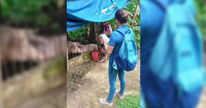
Map Data Collectors (MDCs) are equipped with handheld tablet devices to update the geotagged building structures, validate the boundaries in the barangays, and digitize five selected economic areas in Buenavista and Jordan.
PSA-Guimaras hired two Map Data Screeners (MDSs) to prepare the materials for the activity, assist during the third level training, and finalize the updated geotagged building structures and economic areas while the two MDCs shall update the geotagged building structures based on the data collected in the field and validates economic areas and boundaries.
“The strict implementation on surgical lockdowns and the no crossing of borders are the primary hindrances for our enumerators and geotagging personnel to complete their outputs on time,” Losare said./PN