


[av_one_full first min_height=” vertical_alignment=” space=” custom_margin=” margin=’0px’ padding=’0px’ border=” border_color=” radius=’0px’ background_color=” src=” background_position=’top left’ background_repeat=’no-repeat’ animation=”]
[av_heading heading=’Hazard map a weapon against climate change’ tag=’h3′ style=’blockquote modern-quote’ size=” subheading_active=’subheading_below’ subheading_size=’15’ padding=’10’ color=” custom_font=”]
BY GLENDA SOLOGASTOA
[/av_heading]
[av_textblock size=” font_color=’custom’ color=’#0a0a0a’]
Sunday, March 5, 2017
[/av_textblock]
[av_textblock size=” font_color=’custom’ color=’#0a0a0a’]
ILOILO City – A hydrological and meteorological map recently turned over to Mayor Jed Patrick Mabilog is expected to help the city government improve its climate change adaptation programs.
The map was from BeSecure Project funded by the United States Agency for International Development (USAID).
“The hazard map indicates areas in the city vulnerable to climate change-induced hazards such as typhoons, floods, sea-level rise, drought and strong winds,” said Jose Roni Peñalosa, the City Planning and Development Office coordinator.
The data was gathered from the Philippine Atmospheric Geophysical and Astronomical Services Administration and the Manila Observatory, he said.
Peñalosa recalled that in 2013, the United Nations (UN) Habitat also conducted a “vulnerability and adaptation” assessment of the city’s barangays.
A year after, UN Habitat turned over to the city government a report showing similar hydro-meteorological data as BeSecure’s, he said.
Among others, the map will guide the city government as it update its Comprehensive Land Use Plan, Comprehensive Development Plan, Local Climate Change Action Plan, and the Disaster Risk Reduction and Management Plan.
“Hazard data change every now and then. While we do forecast, we can never really tell what will happen and what won’t happen. Still, updated data are useful in planning more appropriate interventions,” said Peñalosa.
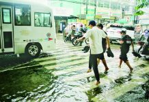
For example, he said, the city government now puts so much investment on drainage re-engineering and in preparing communities to respond to flooding.
Mabilog and USAID BeSecure project leader Elisea Gozun were supposed to meet barangay leaders yesterday and discuss with them the hazard map. For still unclear reasons, however, the meeting did not push through.
Gozun, former Environment secretary, also recently turned over to the city government an analytical map showing coastal areas / barangays that are forecast to experience increased/extended rainfall until the year 2040.
“If this is communicated to our barangay leaders, they would be able to prioritize where to spend their resources,” said Peñalosa./PN
[/av_textblock]
[/av_one_full]