



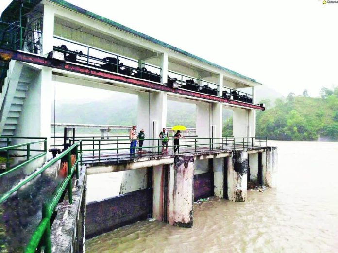
ILOILO City – The National Irrigation Administration (NIA) has urged residents in low-lying and downstream communities in Aklan and Antique to remain alert as continuous rains brought by Typhoon Tino could lead to rising water levels and possible dam gate releases within the next 24 to 48 hours.
NIA engineers said that while most dams in Western Visayas remain within manageable levels, the sustained rainfall over Panay Island may cause rapid inflow, particularly in river systems connected to major irrigation dams such as those in Banga, Malinao, and Ibajay in Aklan, and in the towns of Sibalom and San Remigio in Antique.
The agency has placed its field engineers on-site to closely monitor water elevations and coordinate with the respective municipal and provincial disaster risk reduction and management offices.
“As Typhoon Tino weakens and moves westward, moderate to heavy rains are still expected to persist in parts of Panay Island until November 7, which could maintain elevated river flows and swelling in nearby tributaries,” NIA said in its latest advisory.
The agency has also alerted irrigators’ associations and local communities to stay vigilant for possible gate operations that may be necessary to maintain dam safety.
Residents living near riverbanks and irrigation canals are advised to move to safer areas if water levels continue to rise and to heed local government warnings and emergency advisories.
NIA assured that all dam operations are under constant observation and that updates will be issued should there be any changes in water release conditions.
Typhoon Tino slightly intensified as it moved away from northern Palawan and over the West Philippine Sea yesterday. In its 11 a.m. bulletin, the Philippine Atmospheric, Geophysical and Astronomical Services Administration (PAGASA) noted that the center of Tino’s eye was estimated at 190 km west of Coron, Palawan.
PAGASA said heavy rains, severe winds, and possible storm surges are likely over Palawan and nearby areas.
Strong to gale-force gusts may also be felt in several regions not under wind signals due to the combined effects of the Northeast Monsoon, the shear line, and Tino’s trough. These include Western Visayas, Negros Island Region, Central Visayas, Cagayan Valley, Cordillera, Ilocos Region, Central Luzon, Metro Manila, Calabarzon, Mimaropa, and Zamboanga Peninsula.
PAGASA said Tino will continue to move west-northwestward over the West Philippine Sea and is expected to exit the Philippine Area of Responsibility (PAR) by Wednesday night or early Thursday morning.
The typhoon may re-intensify within the next 12 hours and could reach its peak intensity while traversing the open sea./PN